Detailed Cemetery Information
|
CEMETERY NAME: Saint John's Bismarck ADDITIONAL/ALTERNATE NAMES: Thiele; St. John's BCHC CEMETERY ID NUMBER: 9 THC CEMETERY NUMBER: BQ-C029 THC ATLAS NUMBER: 7035002905 HISTORICAL DESIGNATION: none NEAREST CITY OR COMMUNITY: Cayote USGS 7-1/2 MINUTE QUAD MAP: Valley Mills (3197-423) LATITUDE: 31.73806863 LONGITUDE: -97.49388040 SURVEY NAME AND ABSTRACT NUMBER: | 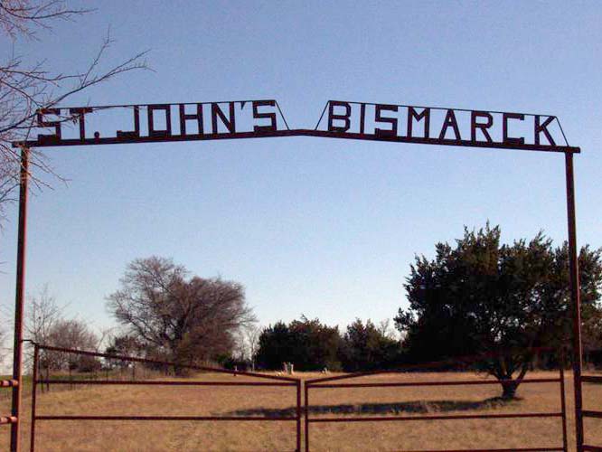 (click image to enlarge) |
| MAP LOCATION (centroid of cemetery): click here to show on Google Maps Map Note: The location shown with the red marker on Google Maps will be the location of either the centroid of the cemetery if the exact location is known or the general vicinity if the exact location is not known. Google Maps may also place its own marker on the map (usually in green) but it is not necessarily reliable. BCHC DIRECTIONS:THC DIRECTIONS: West of Hwy 56 on 3350 at intersection with 3360. BCHC 1985 CEMETERY BOOK: Vol. I, pg. 137Note: The two-volume Bosque County Cemetery Records listed all known cemeteries and all persons buried in these cemeteries at the time of publication. The information included dates from the gravestones and, in some cases, the inscriptions from the gravestones. Although these volumes are now out-of-print, they are available for reference at the Bosque County Collection, and the information contained in these volumes has been converted to an online database searchable by name. NUMBER OF GRAVES: 48 click here to list burials\nLINK TO TEXAS HISTORICAL COMMISSION ATLAS DETAILS: THC Atlas Web Page LINK TO FIND-A-GRAVE ENTRY: Find-A-Grave Web Page NOTES: This cemetery was surveyed by the BCHC on 20 May 1979. It was established by the members of the St. Paul Evangelical Reformed Church which formerly stood nearby. Many inscriptions are in German. |
Go Back to Cemetery Listings Page
